Subseasonal Forecast for California
Recurring winter weather patterns impacting the West Coast are the basis for this forecast product. These patterns have been linked to a variety of impacts over California and the Western US including for atmospheric rivers (ARs), precipitation and temperature, Santa Ana winds and wildfire in Southern California (Guirguis et al. 2022), as well as snowpack in the Sierra Nevada mountains (Guirguis et al. 2024).
Recurring Winter Weather Regimes Impacting the West Coast
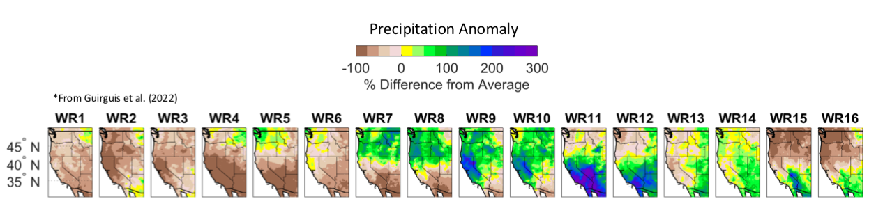
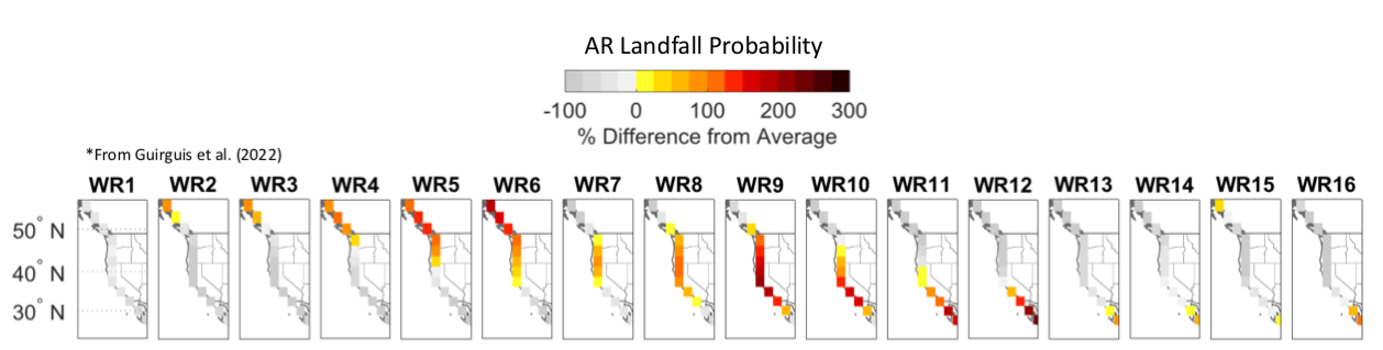
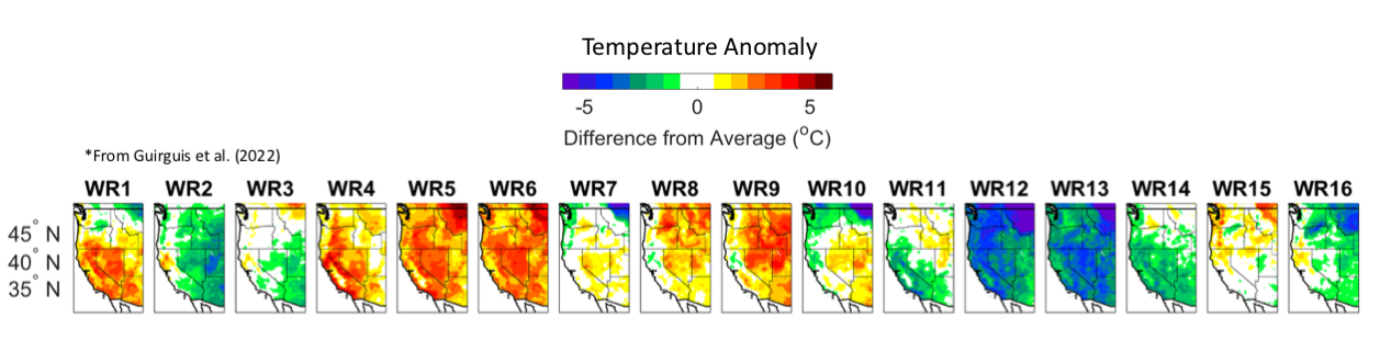
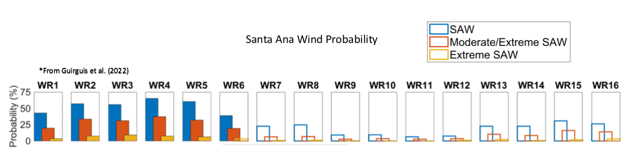
Shown as 500 hPa gepotential height anomalies using NCEP/NCAR global reanalysis (from Guirguis et al. 2022).

Subseasonal Weather Regime Forecast for Weeks 2-3
- The subseasonal forecast is updated twice weekly usually on Tuesdays and Fridays.
- The forecast is based on the likelihood of different weather regimes developing in weeks 1-3.
- Impacts associated with each weather regime are provide below, where users can select tabs for
- precipitation anomaly pattern
- atmospheric river landfall probability
- temperature anomaly pattern
- Santa Ana wind probability
- The weather regime forecast is presented as a grid plot with purple shading indicating an increased likelihood of a weather regime developing in weeks 1-3 using information about atmospheric circulation from the NCEP and ECMWF models (select tab for model choice). The columns correspond to the 16 weather regimes and the y-axis gives the target time period from day 1 through the end of week 3. Purple shading indicates above normal probability, white means unlikely, and yellow means uncertain.
- To use the tool, users can check the weather regime forecast to see which weather regimes are likely to develop in weeks 1-3, and then use the impacts tabs to see what the likely impacts will be.


Atmospheric River Outlook
- The AR outlook product gives the likelihood of an AR making landfall at different coastal locations out to week 4.
- Gold shading indicates too much uncertainty to issue a forecast for that time period.


Atmospheric River Outlook for Weeks 2-3
- The AR outlook product gives the likelihood of an AR making landfall at different coastal locations in weeks 2-3.
- Climatology is provided at left, which gives the historical probability of an AR making landfall during a 7-day period at this time of year.
- The week 2 and week 3 forecasts displayed to the right give the forecast AR probability shown relative to climatology, where the user can select tabs to see results from different dynamical models.
- A forecast for week 3 may not be issued if there is too much uncertainty among model ensemble members about developing weather patterns.

